TopoLT 11.0
Free Trial Version
Publisher Description
Main features of TopoLT:
* draws directly points from coordinate files, draws coordinates from total station or sends coordinates from drawing directly to total station;
* point codes are translated according to a codes interpretation file defined by the user;
* points can be graphically drawn with or without elevations, elevations can be also obtained through interpolation;
* coordinates of sightshot points (polar points) can be calculated including the possibility to import measurements from the majority of existing total stations;
* measurements can be received from an instrument through serial port;
* points can be selected based on code and point codes can be modified;
* point coordinates can be extracted from drawing and saved in different formats, including formats defined at instruments (total stations) or in formats defined by user;
* coordinates tables for selected points can be created, including a separate table for station points;
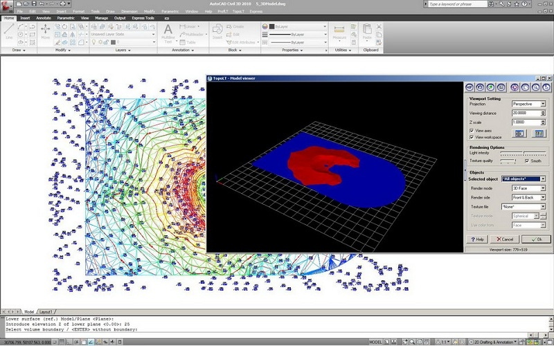
* 3D model of the terrain and contour lines can be generated, volumes can be calculated without any restrictions (the volume obtained by intersecting a 3D surface with a plane or the volume between two 3D surfaces of any grid form or triangles);
* 3D models can be cut or joined;
* entities from a drawing with can be visualized in 3D with real time rendering, AVI movies can be saved with moving three-dimensional objects;
* raster image can be transformed in order to achieve correlation with the coordinates system of the plan and raster images can be both cut and framed at the same time with the process of transformation, raster images can be saved in different formats, colors format can be changed;
*areas can be detached using usual methods from cadastre such as parallel, parallel to one direction, perpendicular, proportional, through an obliged point and with obliged opening;
*the grid can be automaticaly drawn;
*draw polygons, paths or points in Google Earth with the assistance of the TransLT library.
About TopoLT
TopoLT is a free trial software published in the CAD list of programs, part of Graphic Apps.
This CAD program is available in English, French, German, Italian, Portuguese, Romanian, Spanish. It was last updated on 22 April, 2024. TopoLT is compatible with the following operating systems: Windows.
The company that develops TopoLT is CADWARE Engineering. The latest version released by its developer is 11.0. This version was rated by 1 users of our site and has an average rating of 3.0.
The download we have available for TopoLT has a file size of 16.78 MB. Just click the green Download button above to start the downloading process. The program is listed on our website since 2014-04-15 and was downloaded 1,292 times. We have already checked if the download link is safe, however for your own protection we recommend that you scan the downloaded software with your antivirus. Your antivirus may detect the TopoLT as malware if the download link is broken.
How to install TopoLT on your Windows device:
- Click on the Download button on our website. This will start the download from the website of the developer.
- Once the TopoLT is downloaded click on it to start the setup process (assuming you are on a desktop computer).
- When the installation is finished you should be able to see and run the program.
